As communities continue to grow in hazard prone areas (e.g., floodplains, coastlines), knowing whether cities have ways to effectively adapt to future changes in flood hazards and risks is critical to reducing vulnerability and establishing long-term resilience. As climate change and urbanization increase the frequency and severity of flooding across the US, it is crucial that emergency managers, decision-makers, and individuals have access to timely and accurate hazard and risk information.
Climate change impacts on flood hazards
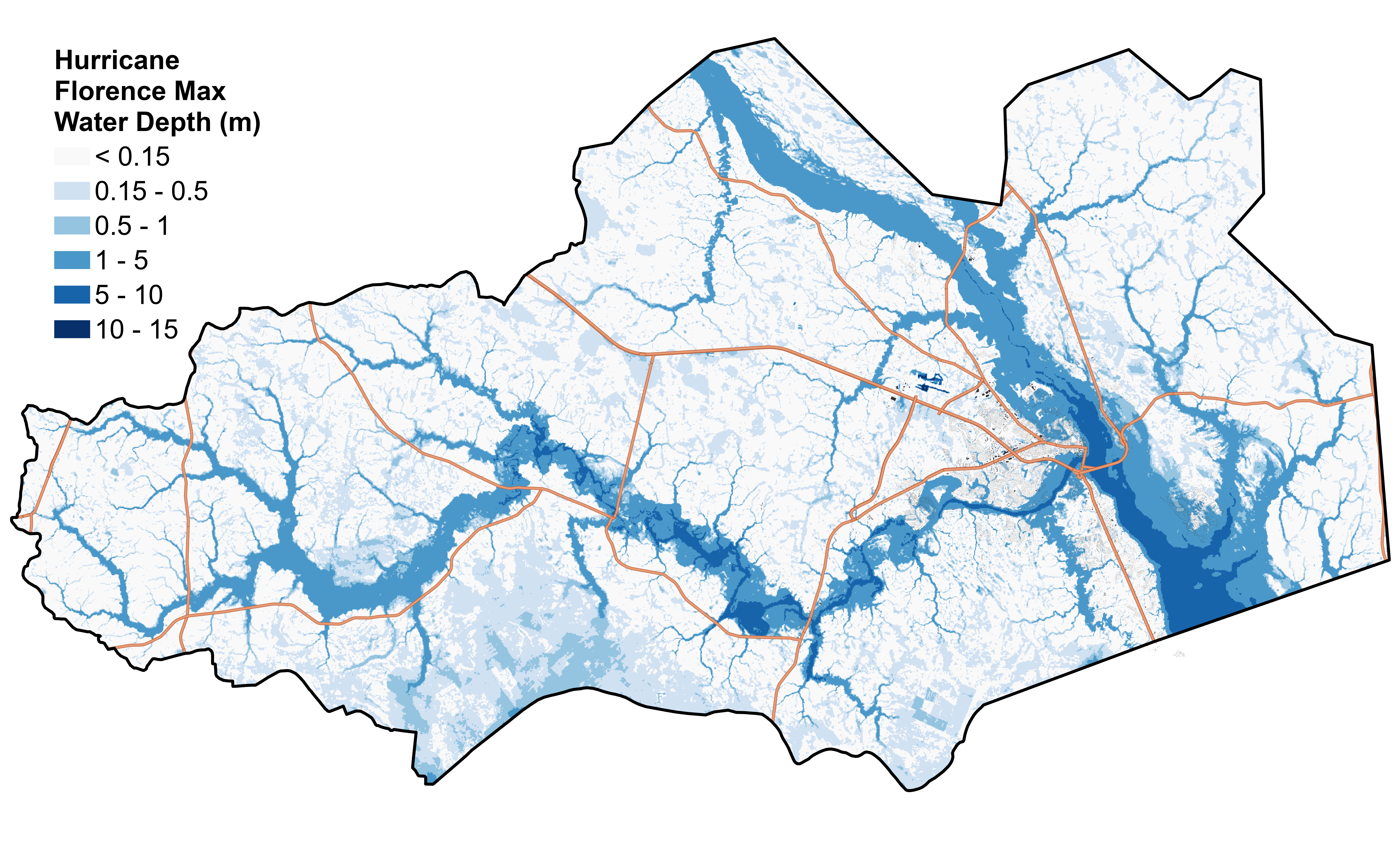
Communities need better information on current and future flood hazards in order for risk reduction measures to remain effective in the long-term. The objective of this project is to quantify the contributions of nuisance and extreme floods to the flood risk profiles of an estuarine community in North Carolina and determine how they are projected to change under future climate conditions. I am building a hydrodynamic model that will be used to generate spatially contiguous maps of flooding across the community for multiple climate scenarios of rising sea levels and increased precipitation. I am using SFINCS (Super-Fast INundation of CoastS) which is a two-dimensional raster-based flood inundation model that can be used to simulate multi-mechanistic flooding at the river-coastal interface. An example of modeled max water depths from compound flooding (e.g., precipitation, streamflow, and storm surge) from Hurricane Florence model is shown below:
Check out a poster I presented at the NC WRRI Annual Conference in March 2022: Exploring the effects of climate change on compound flooding in NC estuarine communities
Measuring nuisance flooding
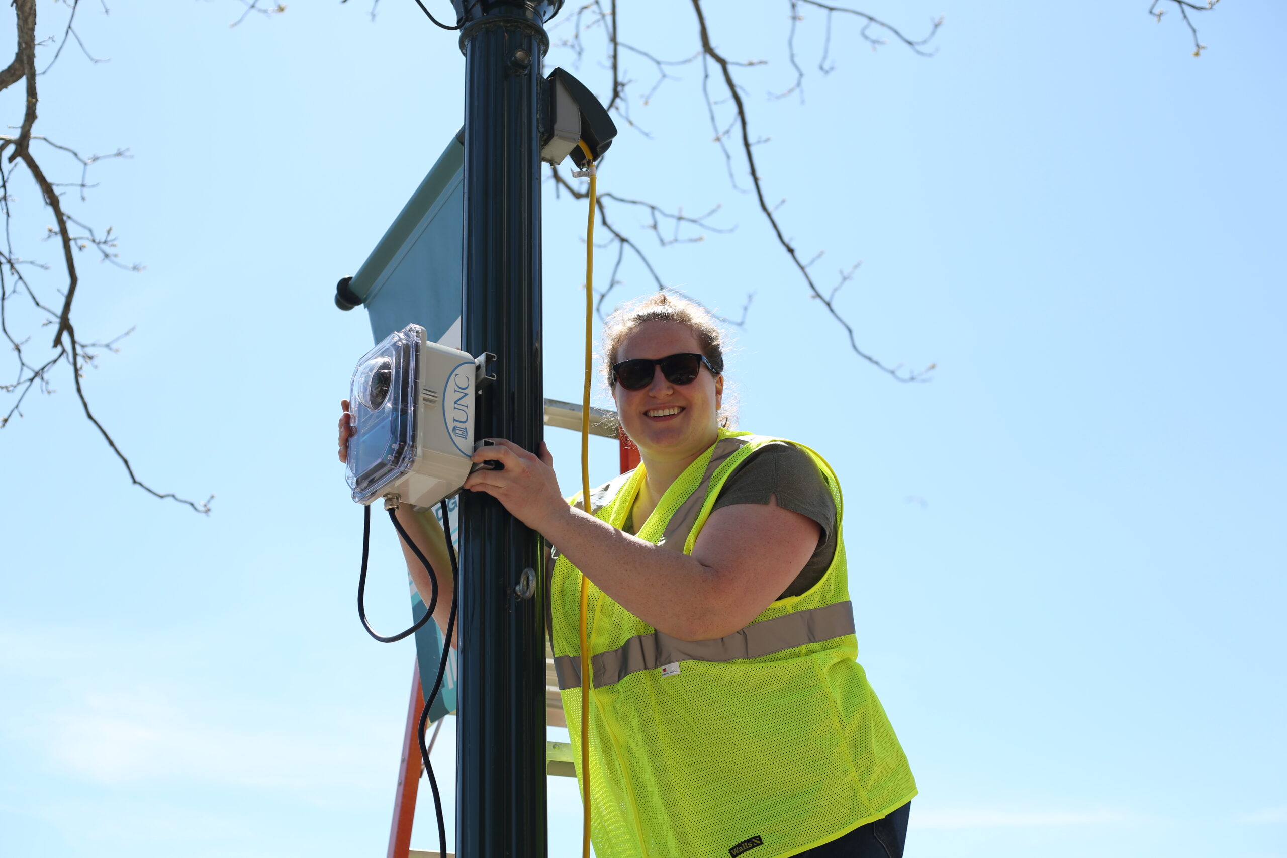
Data on nuisance flooding is necessary for understanding their contribution to risk, especially in estuarine communities where fluvial, pluvial, and coastal processes contribute to flood hazards. As part of the Sunny Day Flooding Project, we will generate valuable records of water levels by deploying custom sensors in North Carolina coastal communities that will provide real-time measurements of water level in storm drains and images of the extent of street flooding, thus enabling improved flood modeling needed for estimating future flood risk. Learn more about the project and check out our sensors and flood cams here.