The weather this week will be, for the most part, boring. However, that’s a good thing. Besides showers Monday morning and Tuesday night, the rest of your school/work week will remain clear. The more moist warmer air we’ve been seeing will subside into a more seasonable cooler and drier Tuesday through Thursday, with the high temperatures hanging in the 60s. On Friday, we’ll see spring-time moisture and warmth return on Friday and into next the weekend, with the chance of Thunderstorm-activity on Saturday. Although Saturday is far out, the models are indicating this has the setup to possibly produce severe weather. As we get closer and closer to the weekend, make sure to check your forecast for any updates and altercations to the forecast. The weather in general, and especially threats of severe weather, can undergo drastic changes, especially this far out into the future.
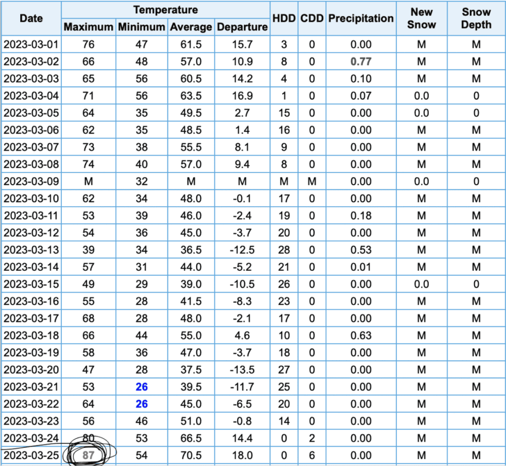
Regarding the heat that we saw on Friday and Saturday, Saturday ended up being a historic one. Saturday tied a daily record for the hottest temperature on record of 87 degrees, tying the mark set in 1939. The 87 degrees that was recorded on Saturday was in Chapel Hill, whereas the historical record data all comes from the RDU airport, according to the National Weather Service. This historical feat will add to an already historically warm start to the year.